Tuesday 30 June 2015

SW Monsoons 2015 June Report Card - Best Performance in 3 years!

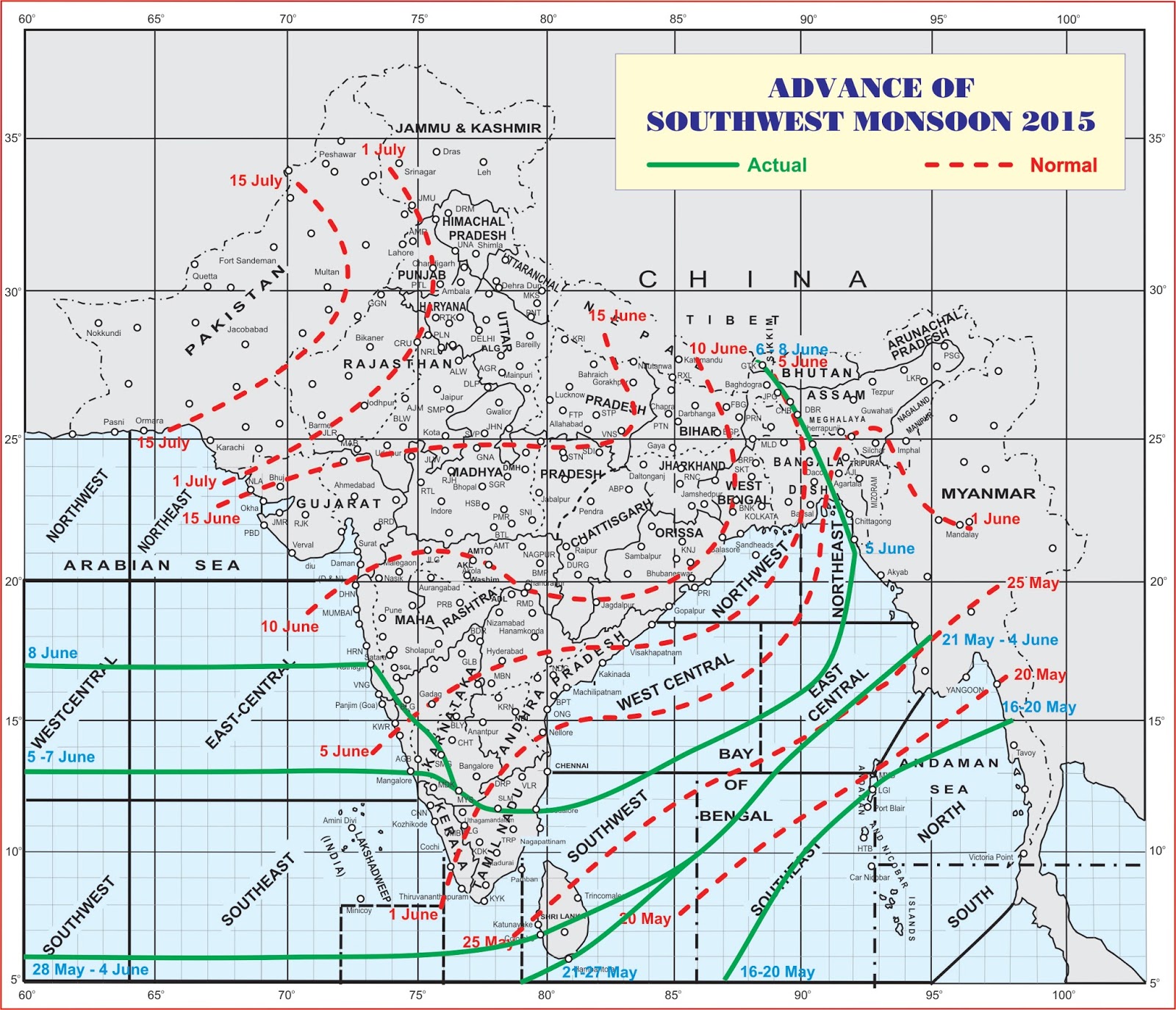
In 2015 SW Monsoon set in Goa a few days late - June 8 according to IMD and June 9 according to Vagaries, against its normal expected onset on June 5. But it still managed to put up its best performance in 3 years.

With an Area Weighted Average Rainfall of 790 mm as at 0830 hrs on June 30, 2015 as against the normal rainfall in June of 906 mm, the rainfall was 13% below normal. But compared to 23% below normal rainfall in June 2013 and 46% below normal rainfall in 2014, this was a stellar performance!


The following graphs tell the story better:


Source: http://www.imdgoa.gov.in

On 11 days there was normal or above normal rainfall. Three days were with Nil rainfall and rest of the days below normal rainfall. Break monsoon like condition was experienced after June 22, mainly due to a deep depression which developed in Northern Arabian Sea and which moved towards Gujarat, taking rains away from Goa, but dumping heavy rains in N. Konkan including Mumbai and South Gujarat. A weak monsoon trough off the west coast also contributed to lots of sunshine and rising day and night temperatures with intermittent rains, mostly in the interior parts of Goa, from June 24th.

Different parts of the state got varying amounts of rain. While Sankhali got 37.41 inch rains, Dabolim got just 26.31 inch rains.


All the towns, however got substantially better rains than in the deficient year 2014:


Rainfall Recorded in June 2015 in mm

These rains auger well for sowing during paddy cultivation. And sowing activities are in full swing all over the state.

The cloud cover and rains brought the day average temperatures down substantially to 31.57C, lowest since October '14. The night low average temperature at 24.63C, indicate the relief from the increase in low temperatures during April and May.


The daily rainfall chart for Vagaries Goa Rain Gauge at Aquem, Margao, is indicative of rainfall in Goa in June:


Goa receives just around 30% of the Seasonal rains in June. So, plenty of action still to come in the remaining three months. Will El Nino have an effect? Or will the Indian Ocean Dipole turn positive and give normal rains?

Watch this space!

Saturday 27 June 2015

Goa June Rains Turning Below Normal; Margao Rain Figures Revised, Sanquelim wettest place so far, Monsoon Covers India - Posted June 27, 2015

Various significant developments are summarised below:

Goa Rains turning below normal:

The weak monsoon activity in Goa last few days, inspite of the trough existing from S Gujarat to Kerala, has halted its march and reversed it to turning below normal as on June 27! As mentioned in this post from June 24, Goa has been receiving average 10 - 20 mm of rain since June 22, resulting in average rains of 765.2 mm till date against normal of 777.8 mm, resulting in -2% below average rains!


As weak mosoon continues over Goa, similar rains of 10- 20 mm over next 3 days would bring down the total to about -10% below normal. The EAUMETSAT water vapour image as of today is indicative of the weak monsoon activity over west coast.


Margao Rain figures revised, Sanquelim now the wettest place in Goa!

IMD Rain Gauge at Margao, located at the Agriculture Department on Quepem Road, had recorded an absurd 200.4 mm rain on June 20, as against 99 mm recorded by Vagaries Goa rain Gauge, just a km away.

A visit to the rain gauge site in Margao showed leakage in the bottom container of the gauge, resulting in wrong measurement by the concerned person, as seen in this video. Upon bringing this to the notice of The Director, IMD Goa, immediate action was initiated by them to repair the rain gauge and at the same time revising the rain figure of June 20 to 91 mm, more in line with Vagaries Goa's readings.

This has resulted in Margao slipping to third position and Sanquelim climbing to number 1, as the wettest place in Goa with 35.59 inches of rain so, far. The usual wettest place Valpoi, which lies just about 15 km from Sanquelim, lags with 30.27 inches.


For details of daily rain measurement at various towns in Goa visit
http://weatheringoa.blogspot.in/p/swm-2015-goa-graphs-and-charts.html

S W Monsoon covers whole of India by June 26


From the onset over Kerala on June 5, S W Monsoon has taken just 20 days to cover whole of India, as per the latest chart released by IMD.

The overall performance of the Monsoons over the country so far has been good, with 27% rainfall over normal as on June 26. Except for Kerala, Bihar, East U.P. and Nagaland, Manipur and Tripura which received deficient rains, all the other sub divisions of the country received normal or excess rains. However rainfall in the months of July and August would determine how monsoon season fares!


Continue to expect intermittent rains in Goa till end of June, with rain amounts 10 - 20 mm. Day highTemperatures would remain 25- 27C, 2 degrees above normal and night lows will see steady rising to above 26C, 2C above normal, as of now. Expect significant cloud cover and less sunshine!

Wednesday 24 June 2015

Respite from incessant rains - Posted June 24, 2015

Goa is enjoying a respite from incessant rains since Monday June 22, 2015, as predicted in this blog post dated June 19th. However Goa experienced gusty winds, breaking tree branches and uprooted trees at many places. This resulted in power failures, with many villages without power for hours. These strong winds were the result of the deep depression AS2 in the Arabian Sea.

The deep depression AS2 lays centered over Arabian Sea just below S. Gujarat for nearly 2 days. In the process it brough heavy rains to Mumbai and North Konkan for two days. However it has drawn moisture from south Arabian Sea, reducing the rains in South Konkan, Goa and further south till Kerala!

The deep depression finally crossed into Gujarat today June 24th, bringing heavy rains to Saurashtra including Surat etc.

The EUMETSAT image of today clearly indicates the rainfall activity over Saurashtra and North Konkan.


Vagaries Goa raingauge at Margao recorded following rains in last 3 days:

Till 8:30 am on June 23 - 7 mm
Till 8:30 am on June 24 - 8 mm
Till 8:00 pm (Time of Posting) on June 24 - 9 mm

The interior regions of Goa got good rainfall in 24 hrs ending 8:30 am on June 24, top 4 places being:

Sanquelim - 42.7 mm
Valpoi - 38.5 mm
Sanguem - 24 mm
Ponda - 23.4 mm

For rain figures at all centres on daily basis visit http://weatheringoa.blogspot.in/p/swm-2015-goa-graphs-and-charts.html

The area weighted average rainfall in Goa till 8:30 am on June 24, is still 10% above normal at nearly 29 inches.

t would appear that if Goa continues to get an average 15 to 20 mm rainfall over the remaining 6 days of June, it could still fall short of the average 953 mm average rainfall for June by about 100 mm, ie by nearly 10%!

The latest GFS Forecasts indicate picking up of Monsoon activity again only in first week of July!

Last two days have seen day's high temperatures 2 degrees above normal, around 31C and low temperatures around 25C, 1 degree above normal.

Expect hot days with intermittent showers over rest of the week, with average rainfall around 15 - 20 mm. More rainfall can occur in the interior parts of Goa.

Sunday 21 June 2015

S W Monsoon Progress over India so far - Posted June 21, 2015

S W Monsoon has been vigorous over most of the southern Peninsula, including Goa since its onset this season, particularly under the influence of the lows AS1 in Arabian Sea out of Gujarat and BB1 in Bay of Bengal.


Howerver till June 20, Monsoon had still not set in Gujarat, WB, and whole of North India.


As a result, even thogu the all India rainfall till June 20 shows 11% excess, the scanty and deficient rains in Bihar, East UP, West UP, Uttarakhand, Punjab and Harayana are a cause of concern.

The rains are expected to cover Gujarat, WB and Bihar on June 21. Delhi might have to wait till June 25 for the Monsoon rains, though pre monsoon rains may start.

Friday 19 June 2015

Heavy rains batter Goa on second consecutive Day - Posted June 19, 2015

The well developed monsoon trough off the west coast of India resulted in second consecutive day of massive rains in Goa from afternoon of June 18 to early morning of June 19.

The rains were widespread and continuous throughout Goa. Out of 13 rain gauge Centres, 7 centres, including Vagaries Goa at Aquem Margao, recorded more than 100 mm in 24 hrs ending 8:30 am on June 19.

The rains recorded above 100 mm were as below:


Vagaries Goa's rainfall total in two days measured massive 244 mm.

These rains have also wiped out area weighted average rainfall for June upto the present, from 14% deficit till June 18!


Goa had received a record 49% deficit rains in June 2014, which were the lowest in 21 years. The normal AWA rainfall for Goa for June is 953 mm. Goa has already received 495 mm rains, more than the 487 mm it received in June 2014. If this intensity of rains continues we may be able to reach the target of normal rains for June, in spite of the fears of El Nino Effect.

The following table gives the city wise rains for June 2014 and for June 2015 till June 19. It shows that Panaji, Mormugao, Mapusa, Dabolim, Ponda and Old Goa have already received more rains than they received in the entire month of June last year. While Valpoi, Canacona, Sanguem, Margao and Pernem are short. But the shortfall seems easily reachable given the number of days of June remaining and the strength of the monsoon so far!


As of 8:30 am on June 19, 2015 the cumulative rains from June 1 at various centres is as below:


The wet spell will continue in Goa till Monday 22nd, with intermittent rains with reduced intensity than seen in last two days.

Thursday 18 June 2015

Monsoon active and vigorous over Goa - Posted June 18, 2015

Goa received the heaviest rainfall of the season so far in 24 hours ending 0830 hrs on June 18, 2015.

As explained in the latest blog post at Vagaries of the Weather  the West Coast Trough is strengthening and under its influence the Monsoon has become active over Goa, South Konkan and coastal Karnataka. In addition a low pressure system BB1 with its associated UAC in the Bay of Bengal, along with another UAC in the Arabian Sea South of Gujarat are very favourable for further advancement of Monsoon. There is also a possibility of Low forming in the Mid Arabian Sea by 20th.


Under its influence, Monsoon will continue to be active over Goa over the weekend,

Daily Rainfall data and are available here:

1) For daily Rainfall totals in Goa:
http://weatheringoa.blogspot.in/p/swm-2015-goa-graphs-and-charts.html


2) For Daily Rainfall Chart at Vagaries Goa, Aquem, Margao:
http://weatheringoa.blogspot.in/p/swm-2015-daily-rainfall-chart-for.html


In the 24 hrs ending 0830 hrs on June 18, Margao (IMD) received the highest rainfall of 115.7 mm (4.56 inches). Sanguem and Sanquelim both received 94.8 mm (3.73 inches), followed by Dabolim 85.9 mm (3.38 inches), Pernem 81.4 mm (3.2 inches) and Quepem 80 mm (3.15 inches). Panjim received 64.2 mm (2.53 inches). Valpoi at the base of the Western Ghats, the wettest place in Goa, however continued to be a laggard and received only 42.5 mm (1.67 inches) the lowest amongst the 13 rain stations in Goa.


However it is too early in the season and Valpoi could receive bulk of its rains in the months to come.

Monday 15 June 2015

Mid June 2015 Monsoon Report for Goa - Late Start but So Far So Good!

As predicted by Vagaries of the Weather in its blog on May 17, the SW Monsoon reached Goa on June 9, nearly 4 days beyond the normal date. But till June 15, it has remained vigorous over Goa. Except for a few days before the onset, every day has seen widespread rains across Goa, with one or two heavy downpours.

As per the area weighted average rainfall across Goa, maintained by IMD, Goa has received 278.2 mm against normal rainfall of 345.2 mm, with a deficiency of -19%, till 0830 hrs on June 15, 2015.

Source: http://www.imdgoa.gov.in

Panaji has received maximum rains during the last 15 days with 15.89 inches of rain, followed by Canacona with 13.72 inches and Margao with 12.58 inches ( Though the rains recorded by IMD for Margao for June 14 at 5.52 inches is disputable, as Vagaries Goa rain gauge located just a km away recorded 2.56 inches, and the rains were normal and steady).


Till 0830 hrs on June 15, 2015

Its too early in the season to make any predictions as to which city will emerge as the wettest place in Goa. But its still surprising to see Valpoi, which is always the wettest place in Goa, occupy the bottom spot in the above chart. So expect some churning as the season progresses and the interiors of Goa start receiving the bulk of their rainfall!

The rains have brought down the Day temperatures dramatically in the first 15 days of June, from 35.2C recorded on June 1 to 27.3C recorded on June 14, which is 2C below normal. The minimum temperatures are now hovering near 23C.


The daily rainfall recorded by Vagaries Goa rain gauge at Aquem Goa shows the pattern of rain:


Monsoons are progressing slowly across India, getting delayed by 5-6 days at most places. The Bay of Bengal branch of the monsoon has remained stationery at least till June 15.

The Monsoon progress chart as released by IMD on June 15:


And though the quantum of rains graph for India can change rapidly day by day, the following graph makes interesting reading:

It shows that overall the country has received 13% rains more than normal, but Goa and Konkan are deficient with -26% rains along with Coastal Karnataka and Kerala too!

Of course these percentages can change rapidly on a day to day basis.

With the progress of the monsoon stalled since June 13 and a low expected to form in Bay of Bengal later this week and aiding the progress of the monsoon in that part of the country, let's see what the rest of the month has in store for India!

Goa can expect steady, normal rains over next few days.

For daily rainfall readings, charts and graphs visit http://weatheringoa.blogspot.in/p/swm-2015-goa-graphs-and-charts.html

Thursday 11 June 2015

Monsoon weak over Goa - Expected to be active after June 14, 2015

Posted June 11, 2015

After the onset on June 9, SW Monsoon has remained weak over Goa, and stalled in South Konkan.


The NW trajectory of the cyclone Ashobaa towards Oman, is held responsible for diverting the moisture away from east Arabian Sea, even though the onset was helped initially by the cyclone in its stage of being a Depression, as it passed along the coast, before veering NW.

Vagaries rain gauge has recorded only traces on June 10 and throughout the day on June 11. The sky in the south west direction was mostly clear, with blue sky shining through throughout the day.


However the influence of Ashobaa over Arabian Sea is now over, and monsoon winds are organizing once again.


Monsoon is expected to progress further and Goa is expected to receive heavy rains after June 15, as the trough develops off the coast.


The day temperature average around 32C and night temperatures around 24C.

Monday 8 June 2015

Monsoon has arrived in Goa on June 8 - According to IMD

IMD in its latest Bulletin released at noon on June 8, 2015, has declared the arrival of Monsoon in Goa, besides Coastal Karnataka and South Konkan.


However Vagaries believes that the Monsoon has covered coastal Karnataka today and will reach Goa on June 9th, based on the monsoon trough strength and SW winds.


The Tropical Storm has now intensified into Cyclone Ashobaa and lies North West of Goa at 17.9 N and 67.2 E, with a NW track.

As Ashobaa moved away from Goa, it helped the South Westerly winds to detach from the Cyclone and for the trough to strengthen, allowing for the swift move of Monsoon into Goa and coastal west India.

Sunday 7 June 2015

Tropical Depression off the Coast of Goa - Strong winds and rains lashing the coast. Posted June 7, 2015, 2.15 pm

Since Morning of June 7th Goa, specially coastal Goa has been lashed by strong winds from southerly direction, instead of the usual westerly direction at this time of the day ( after 10 am). Huge Cumulonimbi with the Pileus haircut(!) were seen off the coast in south west direction. Skies are now overcast and rains with strong winds are lashing the coastal areas, as this is being posted.

All this is due the Tropical Depression, referred to as AS1 by Vagaries, off the coast of Goa and moving in NW direction.


The latest IMD Press Release is reproduced below:

FROM: INDIA METEOROLOGICAL DEPARTMENT

Time of issue: 1130 hours IST Dated: 07.06.2015

Bulletin No.: ARB01/2015/01

Sub: Depression over eastcentral Arabian Sea. Latest satellite imagery and observations indicate that a depression has formed over eastcentral Arabian Sea and lay centred at 0830 hours IST of today, the 07th June, 2015 near latitude 14.50 N and longitude 68.50 E, about 690 km southwest of Mumbai, 740 km southsouthwest of Veraval and 1230 km southeast of Masirah Island (Oman). It would move northnorthwestwards and intensify further into a deep depression during next 24 hrs. Strong winds speed reaching 45-55 kmph gusting to 65 kmph would prevail along and off Maharashtra, Konkan and Goa coasts during next 48 hrs. Sea condition would be rough along and off Maharashtra, Konkan and Goa coasts during the same period. Fishermen along and off Maharashtra, Konkan and Goa coasts are advised to be cautious while venturing into the sea during next 48 hours.


Caution:
Please refer/rely on IMD Bulletins/Advisories for Storms & Weather related matter at http://www.imdgoa.gov.in 

Friday 5 June 2015

IMD announces arrival of SW Monsoon in Kerala and Coastal and South Karnataka

Today June 5, 2015, IMD announced that the SW Monsoons had met all the onset criteria and had set in Kerala and Coastal South Karnataka, including Manalore and Mysore.

IMD had earlier forecast the monsoons to reach Kerala by May 30 +/- 4 days.

However the monsoon currents are weak and are expected to take another 3-4 days to reach Goa.

This Monsoons may reach Goa not earlier than June 9.


Pre - Monsoon rains batter North Goa - June 4, 2015

June 4, 2015 witnessed some heavy thunderstorms in North Goa particularly towards the interior.

Begining 4.00 pm, thunderstorm cells began to form from the western Ghats in the Valpoi, Sanquelim area and by 8.00 pm had spread towards the sea across Mapusa and Panaji.

Sanquelim recorded nearly 4 inches, Old Goa, Ponda and Panaji 2 inches. Mormugao, Dabolim and Mapusa also received substantial rains, bringing down the the temperature and catching late evening commuters by surprise.

However Vagaries Goa Raingauge at Aquem, Margao recorded only 1 mm. While Sanguem and Quepem also in South Goa received only traces.

From http://www.navhindtimes.in
The evening rains brought down the early morning minimum temperature in Panjim to 21.6C which is 4C below normal.

Late evening showers are expected at many places in Goa over the next few days. Monsoon is expected to arrive in Goa by 9th or 10th June, 4 days beyond normal onset.